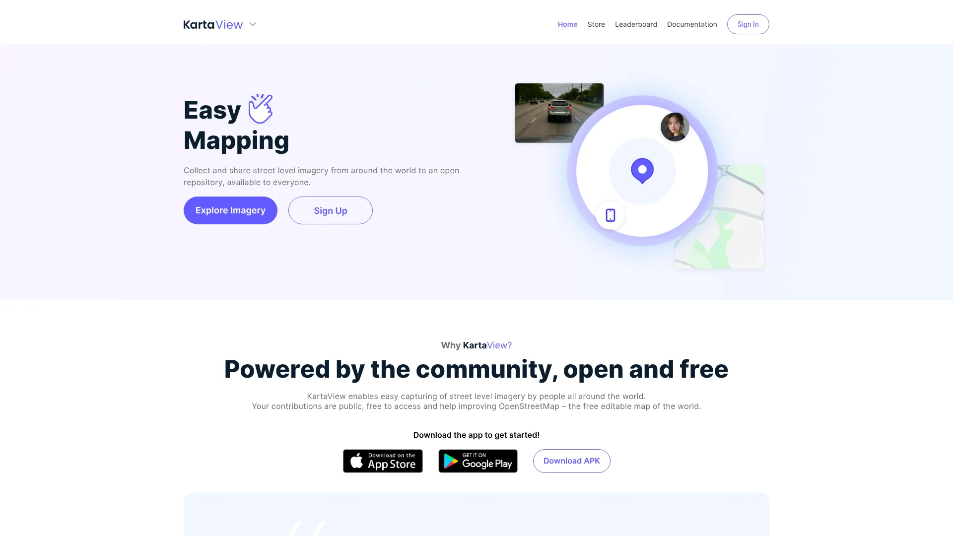

KartaView is a free, open platform for crowdsourced street-level imagery that improves OpenStreetMap. Users contribute photos via smartphone apps, with AI detecting features like signs and lanes. It offers 3D visualization, AI-powered search, and automatic Mapillary sync.
KartaView is a free and open platform dedicated to crowdsourcing street-level imagery for enhancing OpenStreetMap. It allows users worldwide to capture and share photographs using smartphones or GPS-enabled cameras, contributing to a public repository that improves map accuracy and detail.
The platform leverages computer vision to automatically detect features like signs, lanes, and road curvature from uploaded images, making mapping more efficient and accessible. By fostering a community-driven approach, KartaView enables easy collection of imagery during daily commutes or travels, with all contributions publicly available under an open license.
This not only supports OpenStreetMap but also provides tools like 3D visualization and AI-powered search for deeper insights. The platform is designed for volunteers, mapping enthusiasts, and anyone interested in open data, offering a seamless way to participate in global mapping efforts.
To begin using KartaView, download the free app from the App Store or Google Play, or get the APK directly from GitHub for Android devices. Set up takes less than five minutes, allowing you to start recording imagery immediately during your travels or daily routes.
Ensure your smartphone is mounted properly in a landscape position with a clear view, avoiding obstructions like dashboards or wipers for best results. Once recording, the app captures street-level photos that are automatically uploaded to the platform.
After upload, it may take one to two days for personal identifiable information to be removed before the images become publicly available. You can then explore the imagery, use it for OpenStreetMap edits, or sync with Mapillary for broader access, making it easy to contribute to mapping projects from anywhere.
OpenStreetMap contributors and mapping enthusiasts can benefit from KartaView. Volunteers interested in community-driven open data projects will find it useful. Urban planners and researchers needing street-level imagery can leverage its tools.
Travelers and commuters who want to document routes can easily contribute. Developers working with geospatial data and APIs can integrate with the platform. Educators and students in geography or mapping courses can use it for learning.
For assistance, refer to the documentation available on the KartaView website or check the frequently asked questions section for common issues. If you need further help, contact support via email at geo.kartaview@grabtaxi.com for direct inquiries.
The platform also offers community resources and plugins for tools like iD and JOSM to enhance your mapping experience.
Would you recommend KartaView? Leave a comment
The best modern alternatives to KartaView
Recently added tools